
Lahabali kɔligu:Australia satellite plane.jpg

Jɔhiyuli maa galisim:729 × 600 anfooni bihi bihi. Din pahi resolutions: 292 × 240 anfooni bihi bihi | 583 × 480 anfooni bihi bihi | 933 × 768 anfooni bihi bihi | 1,245 × 1,024 anfooni bihi bihi | 2,489 × 2,048 anfooni bihi bihi | 5,250 × 4,320 anfooni bihi bihi.
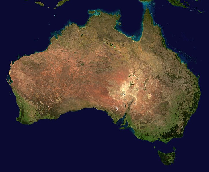
Faal maa maŋmaŋa (5,250 × 4,320 pixels, file size: 1.76 MB, MIME type: image/jpeg)
| Buɣisibu | ||||||
| Nyabli | The image is from here, specifically http://visibleearth.nasa.gov/images/2433/land_shallow_topo_east.tif land_shallow_topo_east.tif, which was cropped at 5250x4320+13390+11880. | |||||
| Sab'sabira | Reto Stöckl / NASA Goddard Space Flight Center | |||||
| Soli tibu (Lahabali kɔligu ŋɔ labitum zaŋ tum tuma) |
|
|||||
| Other versions | Derivative works of this file: Australia satellite states.jpg |

|
Faal tarihi
Dihimi dabisili/saha n-nya kɔl' bihi kamani di ni di yina shɛm
| Zuŋɔ dabisili/Saha | Thumbnail | Di tarisi | ŋun su | tɔhibu | |
|---|---|---|---|---|---|
| din na chana | 16:58, 19 Silimin gɔli May 2005 | | 5,250 × 4,320 (1.76 MB) | Dbenbenn | high resolution version. Cropped land_shallow_topo_east.tif at 5250x4320+13390+11880 |
| 21:10, 13 Silimin gɔli November 2004 |  | 800 × 672 (84 KB) | Bjarki S |
Lahibali kɔligu zaŋ tum tuma
Din doli ŋɔ na yaɣili tuma nima zaŋ ti lahabali kɔligu ŋɔ:
Duniya zaa lahabali kɔligu zaŋ tum tuma
Wikis shɛŋa ŋan dolina ŋɔ gba malila faal ŋɔ n kuri bukaata:
- Zaŋ tum tuma af.wikipedia.org zuɣuc
- Zaŋ tum tuma an.wikipedia.org zuɣuc
- Zaŋ tum tuma ar.wikipedia.org zuɣuc
- Zaŋ tum tuma ar.wiktionary.org zuɣuc
- Zaŋ tum tuma arz.wikipedia.org zuɣuc
- Zaŋ tum tuma ast.wikipedia.org zuɣuc
- Zaŋ tum tuma azb.wikipedia.org zuɣuc
- Zaŋ tum tuma ba.wikipedia.org zuɣuc
- Zaŋ tum tuma be-tarask.wikipedia.org zuɣuc
- Zaŋ tum tuma be.wikipedia.org zuɣuc
- Zaŋ tum tuma bh.wikipedia.org zuɣuc
- Zaŋ tum tuma bn.wikipedia.org zuɣuc
- Zaŋ tum tuma bo.wikipedia.org zuɣuc
- Zaŋ tum tuma br.wikipedia.org zuɣuc
- Zaŋ tum tuma ca.wikipedia.org zuɣuc
- Zaŋ tum tuma ce.wikipedia.org zuɣuc
- Zaŋ tum tuma ckb.wikipedia.org zuɣuc
- Zaŋ tum tuma cs.wikipedia.org zuɣuc
- Zaŋ tum tuma cy.wiktionary.org zuɣuc
- Zaŋ tum tuma da.wikipedia.org zuɣuc
- Zaŋ tum tuma de.wikipedia.org zuɣuc
- Zaŋ tum tuma de.wikivoyage.org zuɣuc
- Zaŋ tum tuma de.wiktionary.org zuɣuc
- Zaŋ tum tuma diq.wikipedia.org zuɣuc
- Zaŋ tum tuma dz.wikipedia.org zuɣuc
- Zaŋ tum tuma el.wikipedia.org zuɣuc
- Zaŋ tum tuma en.wikipedia.org zuɣuc
Yulima more global usage zaŋ chaŋ lahabali kɔligu ŋɔ.