
Lahabali kɔligu:Hinwickhouse.jpg
Aayi di ku lahi tooi yaligi n-pahi.
Hinwickhouse.jpg (640 × 428 pixels, file size: 74 KB, MIME type: image/jpeg)
| Buɣisibu |
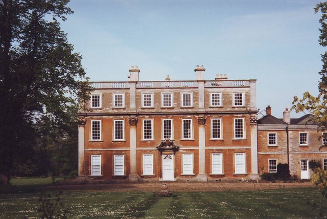
English: Hinwick House, Near Podington, Bedfordshire. The House, not to be confused with the Hall, dates from the 18th Century. It is built with the typical golden sandstone of the region. It is now in the process of restoration. |
||
| Dabisili kalinli | |||
| Nyabli | Geograph | ||
| Sab'sabira | nick macneill | ||
| Soli tibu (Lahabali kɔligu ŋɔ labitum zaŋ tum tuma) |
This file is licensed under the Creative Commons Attribution-Share Alike 2.0 Generic license. ŋmahinli: nick macneill
|

| Camera location | | View this and other nearby images on: OpenStreetMap |
|---|
_heading:270.00&language=dag)
| Object location | | View this and other nearby images on: OpenStreetMap |
|---|
_heading:270.00&language=dag)
Faal tarihi
Dihimi dabisili/saha n-nya kɔl' bihi kamani di ni di yina shɛm
| Zuŋɔ dabisili/Saha | Thumbnail | Di tarisi | ŋun su | tɔhibu | |
|---|---|---|---|---|---|
| din na chana | 18:37, 2 Silimin gɔli January 2011 | | 640 × 428 (74 KB) | Bogbumper | {{Information |Description={{en|1=Hinwick House, Near Podington, Bedfordshire. The House, not to be confused with the Hall, dates from the 18th Century. It is built with the typical golden sandstone of the region. It is now in the process of restoration.} |
Lahibali kɔligu zaŋ tum tuma
Din doli ŋɔ na yaɣili tuma nima zaŋ ti lahabali kɔligu ŋɔ:
Duniya zaa lahabali kɔligu zaŋ tum tuma
Wikis shɛŋa ŋan dolina ŋɔ gba malila faal ŋɔ n kuri bukaata:
- Zaŋ tum tuma en.wikipedia.org zuɣuc
- Zaŋ tum tuma www.wikidata.org zuɣuc